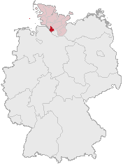
File:Lage des Kreises Pinneberg in Deutschland.png
Lage_des_Kreises_Pinneberg_in_Deutschland.png (176 × 234 pixel, size a di file: 4 KB, MIME type: image/png)
File history
Ef yuh waan see wah di file look like dem time deh, click pon dat date/time.
| Date/Time | Thumbnail | Size | User | Comment | |
|---|---|---|---|---|---|
| lates' | 07:21, 5 April 2007 |  | 176 × 234 (4 KB) | Ditschi | transparent |
| 04:19, 3 March 2006 |  | 176 × 234 (4 KB) | Rauenstein | Karte erstellt auf der Grundlage der opengeodb.de-Umrisse - GNU-FDL Geograv 00:54, 31. Dez 2004 {{Bild-GFDL}} Category:Maps of Germany |
Weh part di file use
Da page yah use dis file:
Weh part di file deh
Dis ya file use inna dem ya wiki:
- Weh part it deh pon ace.wikipedia.org
- Weh part it deh pon am.wikipedia.org
- Weh part it deh pon ang.wikipedia.org
- Weh part it deh pon arc.wikipedia.org
- Weh part it deh pon av.wikipedia.org
- Weh part it deh pon ay.wikipedia.org
- Weh part it deh pon bcl.wikipedia.org
- Weh part it deh pon bi.wikipedia.org
- Weh part it deh pon bm.wikipedia.org
- Weh part it deh pon bpy.wikipedia.org
- Weh part it deh pon bxr.wikipedia.org
- Weh part it deh pon cbk-zam.wikipedia.org
- Weh part it deh pon ceb.wikipedia.org
- Weh part it deh pon ch.wikipedia.org
- Weh part it deh pon cr.wikipedia.org
- Weh part it deh pon cs.wikipedia.org
- Weh part it deh pon cu.wikipedia.org
- Weh part it deh pon cv.wikipedia.org
- Weh part it deh pon cy.wikipedia.org
- Weh part it deh pon dsb.wikipedia.org
- Weh part it deh pon dv.wikipedia.org
- Weh part it deh pon dz.wikipedia.org
- Weh part it deh pon eml.wikipedia.org
- Weh part it deh pon eo.wikipedia.org
- Weh part it deh pon es.wikipedia.org
- Weh part it deh pon ext.wikipedia.org
- Weh part it deh pon ff.wikipedia.org
- Weh part it deh pon fiu-vro.wikipedia.org
- Weh part it deh pon fj.wikipedia.org
- Weh part it deh pon fo.wikipedia.org
- Weh part it deh pon frp.wikipedia.org
- Weh part it deh pon frr.wikipedia.org
- Weh part it deh pon fr.wikipedia.org
- Weh part it deh pon fur.wikipedia.org
- Weh part it deh pon fy.wikipedia.org
- Weh part it deh pon gag.wikipedia.org
- Weh part it deh pon gn.wikipedia.org
- Weh part it deh pon got.wikipedia.org
- Weh part it deh pon hak.wikipedia.org
- Weh part it deh pon haw.wikipedia.org
- Weh part it deh pon hif.wikipedia.org
- Weh part it deh pon hi.wikipedia.org
- Weh part it deh pon hr.wikipedia.org
- Weh part it deh pon ht.wikipedia.org
- Weh part it deh pon hy.wikipedia.org
- Weh part it deh pon id.wikipedia.org
- Weh part it deh pon ie.wikipedia.org
Vyuu more global usage a dis fail.

