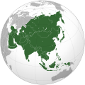
File:Asia (orthographic projection).svg

Size of this PNG preview of this SVG file: 541 × 541 pixel. Adda resolution: 240 × 240 pixel | 480 × 480 pixel | 768 × 768 pixel | 1,024 × 1,024 pixel | 2,048 × 2,048 pixel.
Original file (SVG fail, naminali 541 × 541 pixl, fail saiz: 557 KB)
File history
Ef yuh waan see wah di file look like dem time deh, click pon dat date/time.
| Date/Time | Thumbnail | Size | User | Comment | |
|---|---|---|---|---|---|
| lates' | 13:11, 29 July 2023 |  | 541 × 541 (557 KB) | Bennylin | synchronize with File:Southeast Asia (orthographic projection).svg. Source: File:United Nations geographical subregions.png |
| 19:57, 17 March 2023 |  | 541 × 541 (496 KB) | Golden Mage | A change to the map of Asia will first face debate from others. Hence, a change to the commonly accepted map of Oceania cannot be made without a wider consensus. | |
| 22:44, 16 March 2023 |  | 541 × 541 (557 KB) | Kwamikagami | the Weber line divides Asian from Oceanic Wallacea | |
| 14:29, 4 September 2022 |  | 541 × 541 (496 KB) | Рагин1987 | Socotra repainted | |
| 12:20, 4 September 2022 |  | 541 × 541 (492 KB) | Рагин1987 | Final edit | |
| 07:43, 4 September 2022 |  | 541 × 541 (446 KB) | Рагин1987 | Correction | |
| 08:13, 31 August 2022 |  | 2,048 × 2,048 (1.04 MB) | Рагин1987 | Small correction (Socotra Island is geologically closer to Africa) | |
| 12:59, 13 December 2019 |  | 541 × 541 (242 KB) | Goran tek-en | Added border for South Sudan as requested by {{u|Maphobbyist}} | |
| 05:16, 13 February 2019 |  | 541 × 541 (161 KB) | عبد الله | Reverted to version as of 16:47, 19 September 2016 (UTC) | |
| 05:11, 13 February 2019 |  | 512 × 512 (120 KB) | عبد الله | إزاة خطوط زعجة |
Weh part di file use
Dem 53 page yah use dis file:
- Afganistan
- Ang Kang
- Azabaijan
- Baarien
- Banggladesh
- Brunai
- Buutan
- Filipiinz
- Ieja
- Iijip
- India
- Indoniija
- Irak
- Iran
- Izrel
- Jaadn
- Japan
- Kambuodia
- Kata
- Kazaxtan
- Kiergistan
- Kuwiet
- Laus
- Lebanan
- Makow
- Maldaivz
- Malieja
- Mangguolia
- Mianmaa
- Naat Koria
- Nadoern Saipros
- Nagorno-Karabak
- Nepal
- Oman
- Pakistan
- Piiplz Ripoblik a Chaina
- Rosha
- Saadi Ariebia
- Singgapuor
- Siria
- Sout Koria
- Sout Osetia
- Sri Langka
- Tailan
- Taiwan
- Tajikistan
- Toerki
- Toerkmenistan
- Uzbekistan
- Vietnam
- Yemen
- Yunaitid Arab Emiret
- Template:Di Konchri ahn Terichri a di Ieja
Weh part di file deh
Dis ya file use inna dem ya wiki:
- Weh part it deh pon ab.wikipedia.org
- Weh part it deh pon ace.wikipedia.org
- Weh part it deh pon ady.wikipedia.org
- Weh part it deh pon af.wikipedia.org
- Afrika
- Asië
- Europa
- Filippyne
- Irak
- Israel
- Japan
- Noord-Amerika
- Suid-Amerika
- Volksrepubliek China
- Thailand
- Singapoer
- Maleisië
- Afghanistan
- Sjabloon:Kontinente
- Bangkok
- Katar
- Taipei
- Indië
- Rusland
- Oesbekistan
- Hoofstad
- Lys van hoofstede
- Siprus
- Armenië
- Sjabloon:Lande van Asië
- Iran
- Egipte
- Wikipedia:Sjabloon
- Turkmenistan
- Wikipedia:Lys van sjablone
- Britse Indiese Oseaangebied
- Suid-Korea
- Noord-Korea
- Antarktika
- Beijing
- Gondwana
- Eurasië
- Laurasië
- Kategorie:Lande in Asië
- Libanon
- Jerusalem
- Azerbeidjan
- Bahrein
Vyuu more global usage a dis fail.


